Tuesday, June 3, 2014

Driving the Icefield Parkway

Another spectacular day. On this trip we drove many of America's scenic by-ways - the Blue Mountains Parkway, The Natchez Trace, The Big Sur, The Oregon Coast. But nothing, nothing more spectacular than the Icefield Parkway in Jasper and Banff National Parks in Alberta.

When we left Valemount the weather was not the greatest. Drizzly with low clouds. But we decided to push on taking the Yellowhead Highway to Jasper. We could decide there what to do next.

Mount Robson was our constant companion on this section of the drive:
A moment of excitement when we saw several moose. Unfortunately there was a semi truck behind us and the moose were on both sides of the highway with a narrow shoulder so we could not slow down to take a photo so the one here is a little blurry
It is important to know that the Yellowhead Highway is relatively flat and the favoured route for truckers to take through the Rockies. We did not find their presence a problem (this is not the 401 between London and Toronto) but they are there. At Jasper they will continue of to Edmonton.

Jasper is your typical skiing/hiking town with lots of hotels, restaurants and sports shops. not to mention all other types of shopping. But no big box stores in sight. Its main feature is the historic train station (Jasper was developed as a railway town):
It is now a major stop for "The Canadian" a popular train with dome cars that runs from Toronto to Vancouver. It was pulling into the station as we arrived. People disembarked to spend some time in Jasper while others were enjoying coffee and waiting to board:
About an hour later they were on their way through the Rockies
Also seen in Jasper:
This company rents uniquely painted camping vans, cheap.
Not sure I would want to drive around in this
After a delicious lunch at the Jasper Pizza Place - Arch said it was the best pizza ever, and believe me he eats enough of it to be an expert - we headed down the Icefield Parkway. First excitement was when we spotted a bear grazing at the edge of the highway.

If you see any wild animal on the parkway do not, I repeat, DO NOT get out of your car. In fact the parks service asks that you do not stop the car. Simply slow down, get your photo and keep on going. People who approach the bears are a danger not only to themselves but the bears as well. There is an excellent movie at the Lake Louise Information Centre telling you how to interact with and protect yourself from the wildlife in the park. And protect the wildlife from you.

The drive down the parkway is spectacular:
One of the Park's famous emerald lakes. caused by powdered lime in the melting snow. 
There are two long high passes on the Parkway. The first is the Sunwapta:
Near the top of the pass, but still climbing
Glass skywalks seem to be the latest tourism attraction and there is one that just opened on the Parkway, at the top of the Sunwapta Pass:

We walked on the one at The Grand Canyon several years ago. and were totally unimpressed. It was very expensive. Not only did you pay to go on the skywalk but you first had to pay to enter the Hualapai Nation lands, after driving over 10 miles of dirt road. Then you pay to enter the skywalk. And you cannot take your camera out on the skywalk - they take a photo and charge big dollars for it.

We did not take the Glacier Skywalk but it appears to be much more spectacular and much more reasonably priced. And for $25 we suggest you try it.

Incidentally, Canada's Nation Parks charge a daily admittance fee or you can buy a yearly pass. At $120 for the two of us it is a little more expensive than the US National Parks pass ($80) but very much worth the money if you plan to spend more than 3 or 4 days in the parks system.

There is no parking at the Glacier Skywalk. They bus you up from the Columbia Icefield Centre. The Icefield Centre also offers dry camping spots for $15 per night. That is where we stayed for one night. If you do this be sure to get there early to get a relatively flat spot - it is on the side of the mountain.

We found a spot that was reasonably flat and had a great view of the Athabasca Glacier:
 The glacier is very large. If you look carefully at the lower left corner of this picture you will see a orange spot that is circled. That is a snocat that was grooming the glacier in preparation for the many trips snow machines (large buses) make taking people up to the ice field.

It is a massive area. I took this photo of an info board at the Lake Louise Information Centre that shows the size of this ice field:
The red "X" indicates the Columbia Icefield Centre where I was when I took the picture above and the yellow "X" is the base of the Athabasca Glacier. In my picture the rest of the ice field is up and behind the mountains.

The trip down the mountain from the Icefield Centre is pretty spectacular:
Look over the rail in the centre of the photo.
That small squiggley thing down there between the mountains, under the clouds, is where we are going.
The road down - that is a big curve up ahead!
The only gas station on the Parkway is located at Saskatchewan River Crossing, just as you leave Jasper National park and enter Banff National Park. DO NOT PLAN TO BUY GAS THERE. It was 1.80/litre, expensive even for Canadian prices. Gas at other spots in Alberta was about 1.23/litre so fill up in Jasper before heading down the parkway.

The Weeping Wall:
Way more spectacular than any of the falls we saw at Yosemite
Our next big climb was to the Bow Summit:
Up, up we went
To a frozen Bow Lake and lots of snow at the summit
What goes up must come down
Then more spectacular scenery into Lake Louise where the road becomes a four lane highway and the wildlife is diverted over these especially designed overpasses:

Next post: Lake Louise and Banff.

To enlarge the pictures simply click on them.
You can follow more of our adventures on our facebook page
To contact me click here 
We enjoy and appreciate your comments. To comment simply click on the comments link below

Sunday, June 1, 2014

Time to Speed This Adventure up a Bit

The time has come for us to seriously point the Adventure Bus east and head home to Nova Scotia. In the past 7 months we drove about 13,000 kms and we have 6,000 kms still to go. In 7 weeks. With friends to visit and lots to see. It is time to hustle our butt a little bit. So, with a few exceptions, from now on this blog will be mostly about the drive.

We left Peachland about a week and a half ago and headed north towards Jasper. With a couple of stops along the way. We are still getting the hang of "hustling our butt".

It was a spectacular drive:

Lake Okanagan and Peachland in our rear view mirror
Entering Kelowna from the south
Kelowna is the Okanagan's major city - a very pleasant spot on the lake with good shopping, a beach, lots of golf clubs, wineries and orchards, etc.

North of Kelowna we drove by a number of lakes


Leaving the Okanagan Valley and heading to Salmon Arm BC
Entering Salmon Arm
I believe Salmon Arm is officially considered the north end of the Okanagan Valley. It too is surrounded by beautiful lakes and mountains. We stopped at the Walmart parking lot to make our lunch. Easy in and out.
What a great overnight stop this would make.
Grass, trees and a marshland full of birds on the other side of the fence.
And it is away from the road.
We went around Kamaloops and pointed the car straight north on the Yellowhead Highway (rte 5)
Fire damage in the mountains north of Kamloops
The road followed the North Thompson River most of the way
,
Which, due to snow melt in the Rockies, was very full.

And flowing very fast with lots of rapids.
That night we stayed at the Chinook Golf and RV Park in Barriere, BC. A beautiful spot with a great little golf course that ran along the side of the mountain. So naturally we had to stay an extra day to give it a go.
Arch is standing in the white tee box. The reds are where the two people are behind him. And beyond him you see a person on the green.  A short hole but you hit straight down hill over a large ravine. We both lost balls here.
The next day we entered the land of the big bears
And we pushed on to Valemount BC. The gateway to Jasper National Park. We did not see any bears, basically just rocks, trees and the river.

Next post will be about our drive down the Icefield Parkway in Jasper and Banff National Parks.

To enlarge the pictures simply click on them.
You can follow more of our adventures on our facebook page
To contact me click here 
We enjoy and appreciate your comments. To comment simply click on the comments link below

Tuesday, May 27, 2014

Peachland, British Columbia

As we journey around the United States and Canada many people ask "What is your favourite part of the trip so far?". That is a lot like asking which is your favourite child. And it is true. We loved every place equally. Until now. We love, love the Okanagan Valley.

We've visited many valleys on this trip - the Mississippi River Valley, the Rio Grande Valley, The Yuma Valley, The Valley of the Sun, The Imperial Valley and The Napa Valley, to name a few. But the Okanagan Valley is special.

It is the first to be comprised mostly of lakes. Six actually: Kalamalka, Wood, Okanagan, Skaha, Vaseaux, and Osoyoos. The lakes are surrounded by mountains with orchards and vineyards crawling up their lower reaches. Small towns and cities encompass the lakes, wherever the terrain permits and act as service areas for the wineries, farms and other businesses (including lots of golf clubs) supported by the unique surroundings.

Our original plan was to go to Osoyoos for two weeks but a short drive along the route between Chilliwack and Osoyoos convinced us that it was not the most suitable road for a gas motorhome towing a car. So we decided to come to Peachland. Not that the road was much better. It was four lane but consisted mainly of the 1728 metre (approx. 5500 ft) high Pennask Pass through the mountains. The trip up was slow. The trip down terrifying. Made even more so later when our neighbour in the RV park told us he lost his brakes on the way down.
The view at the top of the pass
But Peachland and the Okanagan Valley are worth the trip
Lake Okanagan
Peachland is the perfect little town. Snuggled into the side of the mountain and with a population of about 5,000 it was a cozy spot from which to explore the mid-Okanagan Valley.

Most activity in town centres on the several kilometre long beachfront. All of which is a public park.

There are waterfront homes but they are across Beach Ave. from the water. That fact does not seem to affect the price of the homes:
2 bedroom, 2 bathroom - $950,000 
There is an inviting and well used path from one end of the beach to the other used by walkers, runners, inline skaters and cautious cyclists, (like me)
The sign you see here is the sign that greets you as you enter the town.
No billboards. Simply what you need to know.
The town (and the whole area) is very bike-friendly.
Drivers are considerate and quite willing to share the road.
There is a small shopping centre supplying all the necessities
The grocery store, gas station, bank, fitness centre, etc.
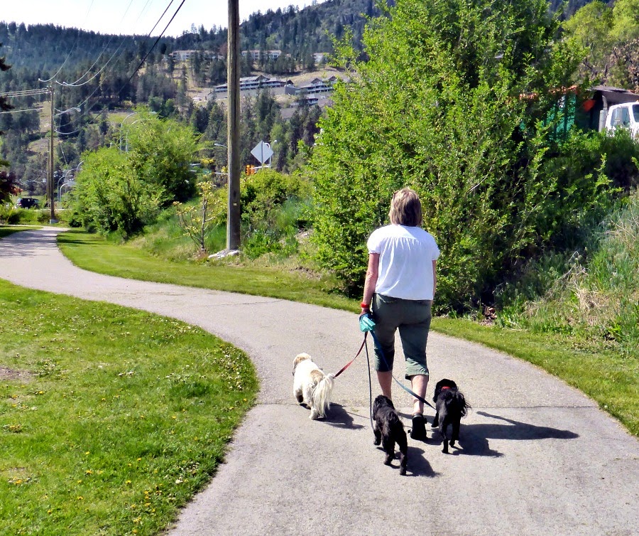
But my favourite is a 1.5 km trail that wound through the village across from the lake.
The entrance from Beach Avenue
It is a fitness trail with lots of activities for all levels of ability.
Lots of  funders involved here
With different pieces of exercise equipment along the way:
Most designed for two people so you and your walking partner can work out together
A skate board park:
With a viewing stand
And a very polite sign outlining the rules:
How many "pleases" can you count
Dog walkers welcome

And at the end a bakery and coffee shop. Where you can relax, enjoy a great view of the lake and regain all the calories you worked off.
Notice the apartments over the shopping area. We saw this a lot in BC.
Such a great idea for St Margaret's Bay development.. 
Also seen in Peachland
Pedal bikes, paddle board, canoes and kayaks for rent.

This picnic area is across from the coffee shop.
There are no walls around homes here. This beautiful patio was part of a condo looking over the lake.
I love the colour combination.
The legend of Ogopogo, believed to live in Okanagan

I could not find and promotion of Ogopogo in the shops - not even a postcard. But this home used his likeness as lawn decor:

Most importantly Peachland, and every other town we visited in the Okanagan, has easily found, extremely clean public washrooms:
Wouldn't it be wonderful if all towns were this thoughtful?
All of these wonderful facilities are maintained by a staff of 7, employed by the town. We saw them out working in the park and its gardens everyday. 

To enlarge the pictures simply click on them.
You can follow more of our adventures on our facebook page
To contact me click here 
We enjoy and appreciate your comments. To comment simply click on the comments link below